
Bachelor Architecture, Urbanism and Building Sciences

Form and Representation
In W2, Form and Representation, the research process is further advanced within the context of design. Through a cohesive set of design exercises and techniques in drawing and modeling, students learn to abstract, document, visualize, and present their ideas.
Digital Design Environment
The WV3 'Digital Design Environment' module uses the powerful capabilities of modelling, simulation and analysis techniques and methods in the computer, which can take architectural digital design to the next level.
Architecture as Science
In the module WV4 'Architecture as a science', the emphasis is on research questions, research methods and reflection, resulting in the writing of a scientific text, the content of which matches the faculty themes.
Computational Design Studio
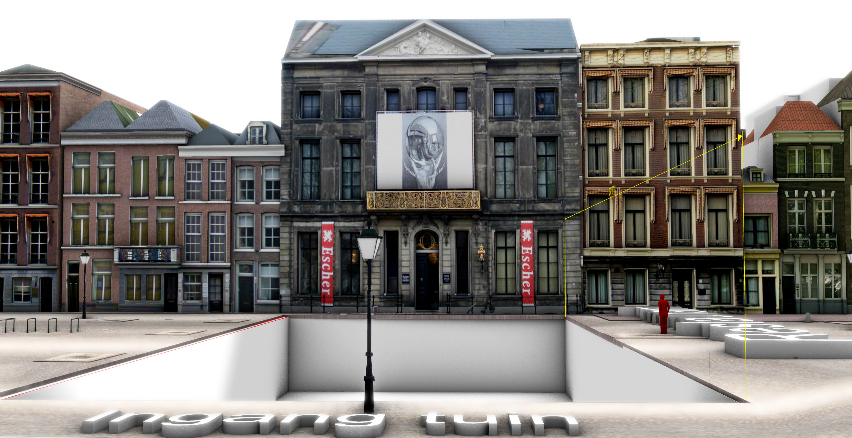
The objective of the course is to design a multi-functional building complex, based on preconditions and environmental data, by utilizing computational tools, methods, and techniques in a workflow.

Spatial Decision Support Systems
The course provides a basis for spatial analysis in a large area. Students learn how to model and visualize the mutual impact of the environment and their design. Students will solve complex spatial decision problems at a geographic scale, for which they apply various simulation and optimization approaches, among other things.
Masters Geomatics & GIMA
Sensing Technologies
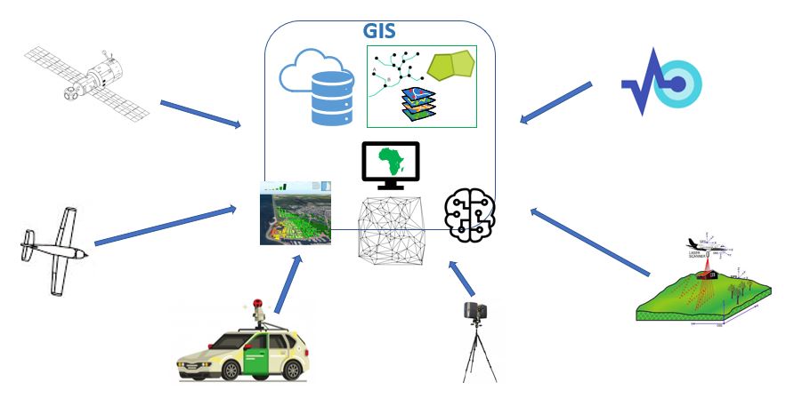
This course provides an overview on the principles and applications of spaceborne, airborne and terrestrial sensing technologies for geographic data acquisition as well as techniques for processing and information extraction from the acquired data.

Python Programming for Geomatics
This course gives an introduction to the Python programming language and focuses on applications for Geomatics in its assignments. Introduction to programming with (mainly) Python and (some) C++.
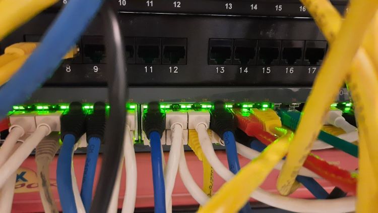
Geo Database Management Systems
This course is about managing geo-information in a database management system (DBMS). The geo-DBMS is the central component of the geo-information chain.
Positioning and Location Awareness
The Geoweb technology course gives a thorough overview of using geo-information on the web and related standards. It includes using, creating and assessing different geo-web services and user interfaces for disseminating vector, raster, sensor, point cloud, and 3D geo-data .
Geoweb Technology
Computational Intelligence encompasses theory and application of computational methods, techniques and tools that have the ability to learn based on given datasets, models and tasks. It includes AI comprising machine learning, bringing together concepts from probability and statistics to programming and optimisation.
Synthesis Project
The project aims at investigating a real-world geo-information problem. Geomatics teachers in cooperation with a company, governmental agency, or a TU Delft research group that is not involved in the Geomatics program the clients define the problem.
Master Architecture, Urbanism and Building Sciences
Introduction to Computational Design
This course aims to introduce the uses of computational design methods within an integrated workflow. It is a hands-on design course in which the students develop skills by working on a design assignment.
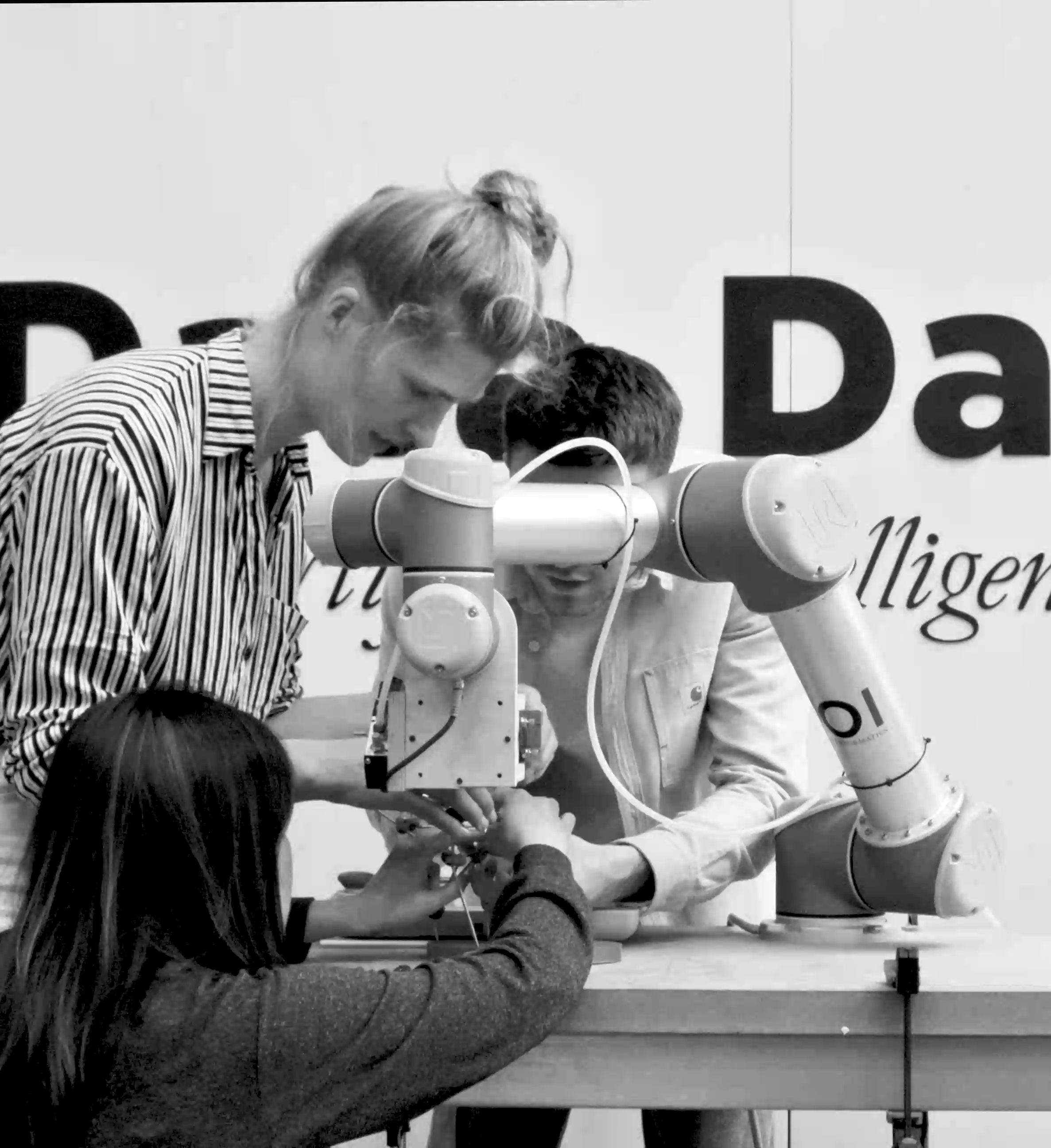
Technoledge Design Informatics
This course aims to introduce digital and robotic fabrication technologies in an integrated computational design to production workflow. It is a hands-on design and build course.

Computational Intelligence for Integrated Design
Computational Intelligence encompasses theory and application of computational methods, techniques and tools that have the ability to learn based on given datasets, models and tasks. It includes AI comprising machine learning, bringing together concepts from probability and statistics to programming and optimisation.

MEGA
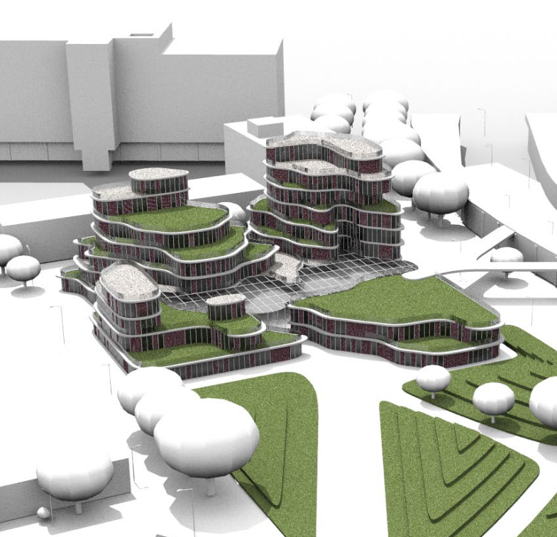
MEGA is a collaborative integral multi-disciplinary design of a special big and/or tall building. This could be a multifunctional skyscraper or a multifunctional building with a large span, such as a stadium, a sports facility, a museum, or transport hub.

Online Digital Portfolio
The student is taught to design and construct a presentation portfolio. This portfolio is presented on-line by means of a web browser. The portfolio contains a relevant summary of both the education parts followed by the student during the Bachelor and Master 1 and any extra-curricular activities.
Beyond 3D Computer Visualisation
The students create within 10 weeks a visualization of a quote derived from a book, speech or song. The visualization can be a single high resolution poster or a VR environment. They use advanced software like Maya, Mudbox, Substance Painter and the Unreal game engine in combination with the HTC Vive for the VR.
Creative Robotics
This is an interfaculty course that explores robotics technologies within the creative industries, particularly those closely relevant to spatial design. It aims to enhance students’ understanding of robotics through applied, critical, and speculative approaches focusing on the relationships between robots, humans, and environments.
Graduation Projects
We supervise students in various Master tracks at the BK Faculty. The interdisciplinary projects range in their focus and some include the application of AI in architecture, engineering, and GIS, data structure and management for the built environment, and additive manufacturing, and material studies.
Master MADE